Dedicated tool page

Coordinate Transformation
GK5, GK6, GK7 and WGS84

A dedicated page for the GeoKantar tool that converts coordinates between Gauss-Krüger zones and WGS84. It is built for surveyors, designers, contractors and teams working with coordinates in the field, reports or project documentation.

4 supported systems
1 click to Google Maps
0€ for the web tool
GeoKantar transformacija koordinata

A clearer signal for both users and Google

The focus here is on one task only: fast and accurate coordinate conversion.

Clear search intent

The page is focused on queries such as “coordinate transformation”, “GK to WGS84” and similar terms.

Faster path to action

Users see the tool immediately, enter coordinates and get a result without going through other modules.

Instant map check

After conversion the result can be opened directly in Google Maps, which is especially useful in field work.

GeoKantar coordinate transformation tool

Convert coordinates between GK5, GK6, GK7 and WGS84. Copy the result or open it directly in Google Maps.

Transformation result

When this page is most useful

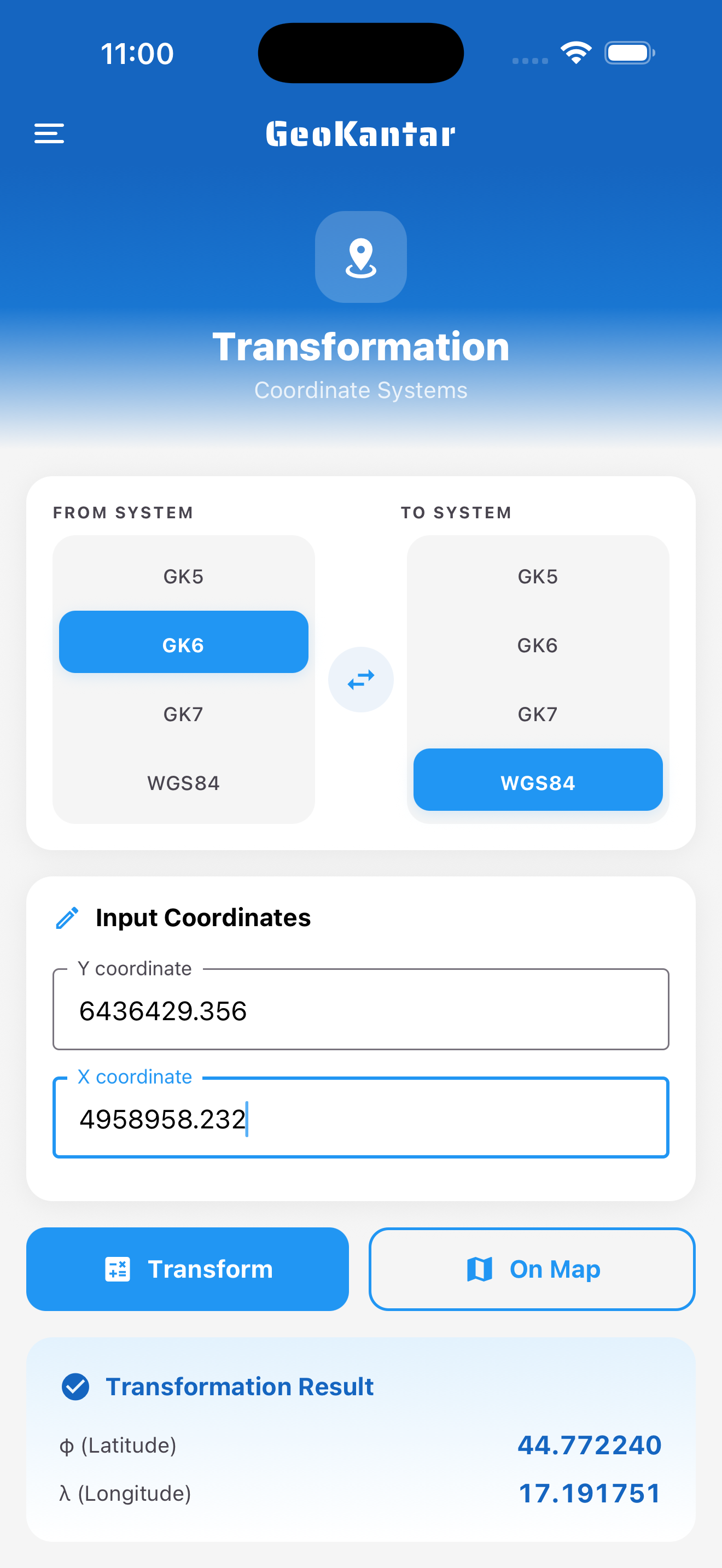
It brings the most value when someone needs to quickly convert a single coordinate pair and verify the result on a map.

  • Checking a single point before going to the field
  • Converting coordinates for reports or communication
  • Fast control between GK and WGS84 systems

Logical next step

When a single conversion is not enough, the next step is usually bulk processing, DXF/KML conversion or project work on the map.

  • Use bulk transformation for larger point sets
  • Use the DXF to KML/KMZ converter for Google Earth workflows
  • Use the MapaDXF module for project-based map work

Who this tool is for

It is most useful to professionals who need to align coordinates between field data, GPS points and office processing.

  • Surveyors validating individual points
  • Designers who need a WGS84 location view
  • Contractors aligning field data with maps and documentation

Related GeoKantar tools

These modules naturally continue the workflow after single-point coordinate transformation.

Common questions about this tool

Short answers before you start using the coordinate transformation tool.

Which zone should I choose?

That depends on the area and the existing surveying material you are working with. In practice, you should follow the system already used on the project.

Does the tool work with WGS84?

Yes. You can enter WGS84 latitude/longitude coordinates and convert them to Gauss-Krüger zones, or the other way around.

Can I check the location on a map right away?

Yes. After transformation, a button appears that opens the result directly in Google Maps.

Need the rest of the GeoKantar toolset too?

If you also need bulk processing, DXF/KML workflows or the MapaDXF module, get in touch and we can shape a workflow for field work, office processing and project documentation.